GEOL2020WEST44597 GEOL
Campanian-Maastrichtian Ankylosaurs of West Texas
Type: Graduate
Author(s):
Bryanna West
Geological Sciences
Advisor(s):
Arthur Busbey
Geological Sciences
View Presentation
ENSC2019HUDGENS33438 GEOL
Monarch Butterfly Population Decline
Type: Graduate
Author(s):
andrew hudgens
Geological Sciences
Advisor(s):
Tami Morgan
Geological Sciences
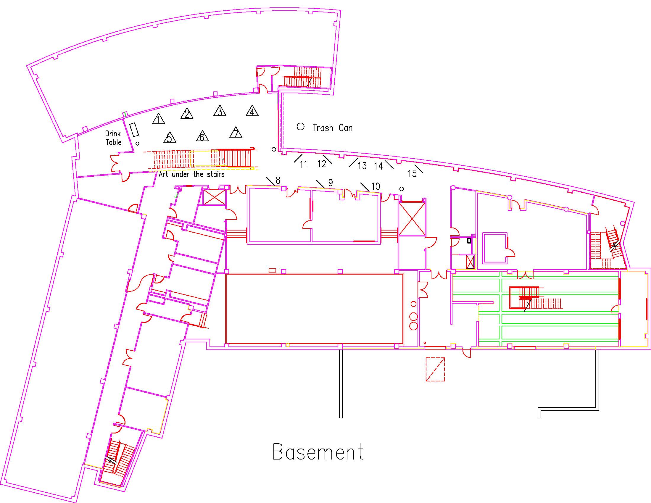
Location: Session: 2; Basement; Table Number: 2
View PresentationMonarch butterfly populations in North America have declined by approximately 80% over the last 20 years. Many contributing factors are responsible for this decline, however the loss of Milkweed has been identified as a major factor. Milkweed is the primary food source for Monarch caterpillars. A GIS analysis was performed to identify milkweed resources in the North Texas area.
GEOL2019CAVES50910 GEOL
Understanding Metal-Silicate Mixing in Mesosiderites
Type: Graduate
Author(s):
Lindsay Caves
Geological Sciences
Advisor(s):
Rhiannon Mayne
Geological Sciences
Location: Session: 1; 1st Floor; Table Number: 5
(Presentation is private)Mesosiderites are meteorites composed of equal parts metal and crustal silicate material, which have been linked to the HED parent body 4Vesta. The metal portion of mesosiderites is also compositionally similar to the IIIAB irons. Mesosiderite silicates were mixed with metal, recrystallized and rapidly cooled. The slow metallographic cooling rates recorded by mesosiderite metal indicate mixing followed by deep burial within an asteroidal body. Several models for the formation of mesosiderites have been proposed, but no single model can completely explain their multi-stage history. Oxygen isotope compositions of mesosiderites and eucrites are identical, consistent with the HEDs and mesosiderites originating from a common parent body. However, there are notable differences between the two groups. These include the differing Fe-Mn-Mg systematics in mesosiderite pyroxenes, which reflect an FeO reduction trend and not the magmatic trend seen in the HEDs. Phosphates and tridymite are also more abundant in mesosiderites than howardites and eucrites. These differences have been attributed to redox reactions that occurred during the metal-silicate mixing stage of mesosiderite formation. As previous work focused mainly on the silicate portion, this study examines the metal of five mesosiderite samples of varying petrologic class and degree of metamorphism. Thick sections of each meteorite containing both matrix metal and metal nodules were requested on loan from the National Meteorite Collection, located in the National Museum of Natural History, Department of Mineral Sciences. Electron microprobe (EMP) analyses of both silicate and metal portions of each mesosiderite were collected, as well as LA-ICP-MS analyses of the matrix metal and metal nodules within each section. The dataset will be analyzed for evidence of redox reactions and other processes that may have been occurring during the metal-silicate mixing phase of mesosiderite formation. If redox reactions occurred between the metal and silicate portions of mesosiderites, then: 1) the matrix metal within mesosiderites may be depleted in readily oxidizable elements (e.g. P, W) relative to the metal nodules that are not in contact with the silicate phase; or, 2) all metal in mesosiderites is depleted in readily oxidizable elements. This depletion should be visible when compared to IIIAB irons of a similar composition.
GEOL2019DEBONE30636 GEOL
Newly discovered old volcano in Big Bend National Park
Type: Graduate
Author(s):
Kristin DeBone
Geological Sciences
Tamie Morgan
Geological Sciences
Advisor(s):
Richard Hanson
Geological Sciences
Location: Session: 2; Basement; Table Number: 8
(Presentation is private)Recent field work has discovered a volcanic complex within the Paleocene Black Peaks Formation in the northwestern part of Big Bend National Park in west Texas. This is the only known Paleocene volcano in west Texas. We have identified pyroclastic deposits consisting of ash-sized and coarser clasts, including volcanic bombs and blocks, which were erupted explosively from a nearby vent. Margins of the volcanic complex have been mapped using remote sensing because the volcanic rocks are distinctly different in color from the adjacent shale. Characteristics of the pyroclastics suggest derivation from phreatomagmatic eruptions, which occurred when magma and groundwater violently interacted in the shallow subsurface.
GEOL2019DONAHOO65357 GEOL
Using Non-Invasive Geophysical Techniques in Near-Surface Infrastructure and Agricultural Planning and Management
Type: Graduate
Author(s):
Michaela Donahoo
Geological Sciences
Advisor(s):
Omar Harvey
Geological Sciences
Location: Session: 2; 3rd Floor; Table Number: 7
View PresentationUsing Non-Invasive Geophysical Techniques in Near-Surface Infrastructure Planning and Management
Michaela Donahoo1, Karim Ouamer-ali2,3, Youcef Daoud2, Kaddour Djili3, Omar R. Harvey1
1Department of Geological Sciences, Texas Christian University, Fort Worth, Texas, USA.
2 National Institute of Agronomic Research of Algeria (INRAA), El-Harrach, Algeria.
3Ecole Nationale Supérieure Agronomique (ENSA), El-Harrach, Algeria.Understanding soil characteristic variability geospatially as a function of depth and time is key to the optimal implementation of subsurface infrastructure planning and expansion. The soils physical behavior as well as its interaction with piping and road materials determine where such a system could divert and predict future maintenance frequency. Central to the development of site-specific, precision management strategies is the quantification and mapping of the geospatial variability in soil properties at significantly higher resolutions than provided in current soil surveys. The presentation will cover results from ongoing collaborative research efforts between researchers at Texas Christian University and two Algerian institutions in using non-invasive measurements of bulk apparent electrical conductivity (ECa) to quantify and map 3-D soil variability in semi-arid and arid areas of Algeria, Northern Africa. The focus will be on the derivation and application of depth-specific ECa-ECe (saturated paste), ECa-clay content and ECa-water content relationships for use in understanding seasonal salinity and water dynamics within potential depths of construction interest.
GEOL2019LAMB52985 GEOL
A Source to Sink Analysis of the Dockum Group in the West Texas Highplains
Type: Graduate
Author(s):
Grayson Lamb
Geological Sciences
Advisor(s):
John Holbrook
Geological Sciences
Location: Session: 1; 3rd Floor; Table Number: 9
(Presentation is private)The fundamental understanding of any geologic basin stems from ascertaining the relationship between its source and sink. Every basin is therefore identified as a “sink” and has a provisional “source.” The investigation of this fundamental relationship is the preliminary exploration step to further basin development.
The Late Triassic Dockum Group of the west Texas high plains is an understudied group that begs investigation into the source to sink relationship. A comprehensive study of the Dockum Group as a “sink” is here undertaken in order to better understand the paleoclimate and its implications on the Dockum group depositional style. This study focuses on the northern most section of the Dockum group outcrop system. Within the study area it is subdivided into three main formations, the Tecovas mud, Trujillo sand, and Cooper Canyon sand-mud mix system.
This study showcases a forward stratigraphic modeling software, Dionisos Flow. From field based outcrop work: grain size, channel thickness, water discharge, and lithofacies assemblages were quantified as model inputs in Dionisos Flow.
The study aims to model Dockum Group sedimentation in order to determine the plausible paleoclimate, and its related depositional environment and depositional style. To do so, an outcrop study and fluvial architecture analysis was completed to serve as model input variables. Then a forward stratigraphic Dionisos Flow model of the three main Dockum Group formations was generated. It was then analyzed and coupled with the outcrop study to draw conclusions on the necessary Triassic climate conditions to produce the Dockum Group deposits.
Per the modeling exercise and outcrop study it is concluded that the Triassic climate was highly variable, shifting between semi-arid to humid. Its variability has been underemphasized in previous studies. Climate alterations are on a scale of 103 years. Additionally, the Dockum Group’s sedimentation style has been a forum of contradicting theories. This study has concluded that Dockum sands were deposited in a predominantly upper flow regime environment during humid climate cycles, while its abundant muds were deposited in lower flow during semi arid climate cycles.
GEOL2019MIRKIN10373 GEOL
Background Color Matching in Texas Horned Lizards
Type: Graduate
Author(s):
Stephen Mirkin
Biology
Advisor(s):
Tamie Morgan
Geological Sciences
Location: Session: 2; Basement; Table Number: 1
View PresentationTexas horned lizards are a threatened species in the state of Texas with declines attributed to a variety of factors including: habitat conversion, pesticide use and red imported fire ants. These cryptic lizards in their natural habitats utilize a variety of anti-predator defense mechanisms. The primary defensive adaptation to avoid predators is often cited as their cryptic coloration, which is often suggested to color match the background substrates of the regions where they are found. Although background color-matching is purported to be an important factor in horned lizard defensive strategies it has never been empirically tested. Here we present the first known study of background color matching of Texas horned lizards in the state of Texas. We used a GIS analysis using soils and satellite imagery data to test how well Texas horned lizards match the soils and substrate in different regions of Texas.
GEOL2019PEREZ40118 GEOL
Area Growth of Fort Worth, Texas in Zip Codes 76131, 76177, 76137, and 76244
Type: Undergraduate
Author(s):
Dylan Perez
Geological Sciences
Advisor(s):
Tamie Morgan
Geological Sciences
Location: Session: 2; 3rd Floor; Table Number: 1
View PresentationOver the last 20 years significant growth has occurred in the northern part of Fort Worth, Texas defined by the zip codes 76131, 76137, 76177, and 76244. Using GIS analysis, this project measured the amount of open area lost and the growth of residential and commercial areas.
GEOL2019STIEFFEL51148 GEOL
Evidence for an Old Parana delta and Diachroneity in Global Highstands
Type: Graduate
Author(s):
Rodney Stieffel
Geological Sciences
Advisor(s):
John Holbrook
Geological Sciences
Location: Session: 1; 2nd Floor; Table Number: 4
View PresentationThe highstand deltas of the Holocene tend to each initiate with the peaking of eustatic sea level rise at about 7000 y.b.p. While generally tied to this time, the initiation of highstand shorelines is not necessarily synchronous. Local impacts on relative sea level can impact this timing. In particular, the Parana Delta, Argentina, appears to have initiated as early as 8100 y.b.p., well before the global sea level peak and potentially before any comparable highstand shorelines. The Parana Delta encompasses an area of ~17,400 km2 enclosed in the Rio de la Plata estuary, growing steadily at a rate of approximately 2 km2 yr-1 for roughly the past 6000 yrs. This deltaic system has shifted from fluvial, to wave-dominated, and then back to its present day fluvial dominated system. Aerial and satellite imagery, shallow boreholes, radiometric dating of shells and sand, and Ground Penetrating Radar are used to define the distinctive sedimentary features of the delta. New data from the upper part of the delta indicates the Parana Delta initiated well before the 6000 y.b.p. previously reported. Sediment cores collected from across the upper delta are used to identify sedimentary facies and construct a stratigraphic framework. Three OSL samples collected from the oldest set of beach ridge s indicate the first ridges formed approximately 8100 years ago. These beach ridges are <3 m above sea level and argue for an early peak in relative sea level. Highstand strata are about 6 m thick above a thin (1-2 m) condensed section above transgressive shoreface deposits. The Parana delta initiated at least 1500 years before the sea level peak. Assumptions of synchronicity of highstands with eustatic sea level accordingly must be tempered with comparable allowance for local error.
GEOL2019TALBERT42796 GEOL
Lower Permian and Pennsylvanian Stratigraphy and Shale Gas Potential of the Palo Duro Basin
Type: Graduate
Author(s):
Brendan Talbert
Geological Sciences
Advisor(s):
Cheyenne Xie
Geological Sciences
Location: Session: 2; Basement; Table Number: 11
View PresentationThe Palo Duro Basin is a northwest-southeast trending cratonic basin in the Texas Panhandle that formed from uplift of the Amarillo/Wichita Mountains during the Pennsylvanian, and subsequent subsidence during the Permian. Sediments were deposited in a number of environments, the most prominent being fan-delta, carbonate shelf, and deep basin settings. Major lithologies in the Pennsylvanian are granite wash, shelf-margin carbonates, and basinal shales, while the Permian hosts the same lithologies, as well as numerous evaporites and red-bed sequences.
This study analyzes log data from 100+ wells in the Palo Duro Basin to correlate and determine the lateral extent of different facies throughout the basin during the Pennsylvanian and Permian. Cross-sections made will help to generate isopach, structure, and other geological maps to identify areas where further geochemical and/or petrophysical analyses can be performed to evaluate Pennsylvanian and lower Permian shale gas potential of the Palo Duro Basin. This project will establish a more detailed stratigraphic framework of Pennsylvanian and lower Permian aged sediments of the basin, as well as determine source rock quality and thermal maturity for potential shale gas plays within the Palo Duro Basin, with a more thorough look along the southern fringes of the basin near the Matador Arch.
GEOL2019TERRELL64068 GEOL
Pennsylvanian and Mississippian Stratigraphy, Little Hoss Ranch, Johnson County, Fort Worth Basin, Texas
Type: Graduate
Author(s):
Aro Terrell
Geological Sciences
Advisor(s):
Richard Denne
Geological Sciences
Location: Session: 1; 2nd Floor; Table Number: 7
(Presentation is private)The primary objective of this study is to test my hypothesis that the stratigraphy within Little Hoss Ranch is very complex and diverse but correlative to the surrounding strata of similar depth and characteristics. The second objective is to identify characteristics of the stratigraphic facies to better aid in the production via recompletion or other determined methods within the Little Hoss area. Seismic data that will be analyzed within Little Hoss Ranch are made available by TEP Barnett. Seismic analysis will be done using Kingdom and will be assisted by the TEP geophysicist when possible. The goal is to use these data to better identify faults and other significant structural features within the area as well as the Barnett Shale stratigraphy for LHR. A map will be made using the seismic data and logs will be included in the map for reference and quality check purposes. The seismic, well log, and cutting data for the LHR that will be analyzed was originally acquired by Chesapeake as early as 2008 and is now owned by TEP, Barnett. 127 well logs will be analyzed using PETRA, within and immediately adjacent to the Little Hoss Ranch area, to better correlate and map the stratigraphy within the Little Hoss Ranch and will be tied to the LHR wells with surrounding wells in Johnson County and Tarrant County to create regional cross-sections. An additional cross-section will be created with the wells to the north in Tarrant County to display structural trends and stratigraphic facies correlation. The 127 LHR wells will be used to create a detailed structure map that can be compared to the seismic time structure map. The BHT will be used from the well logs as well as production data (oil to gas ratio) to determine if differential thermal maturity occurred within the area The overall goal of this project is to analyze the stratigraphy and structure of the Barnett Shale play within the Little Hoss Ranch confines and to identify any geologic effects or geologic solutions to marginal production for the area of study. Seismic data, well-logs, core and cuttings, mud-log descriptions, and background literature research will be used to conduct a thorough investigation into the stratigraphy affecting the LHR. The wells in the LHR will be used with wells in northern parts of the Fort Worth Basin to create a cross section spanning a larger area. This will help to better correlate the stratigraphy for the basin and help identify depositional and erosional changes in the Fort Worth Basin. Additionally, the OGIP data and calculations will be used to help define what the remaining hydrocarbon value is for the Barnett Shale within LHR.
GEOL2019TOTZ51136 GEOL
A GIS Analysis of Crustal Stress Directions and Orientation of Horizontal Drilling in the Permian Basin in West Texas
Type: Undergraduate
Author(s):
Samuel Totz
Geological Sciences
Advisor(s):
Tamie Morgan
Geological Sciences
Helge Alsleben
Geological Sciences
Location: Session: 1; 2nd Floor; Table Number: 6
(Presentation is private)The World Stress Map (WSM) is a global compilation of information on the stress field of the present-day earth crust and is maintained since 2009 at the Helmholtz Center Potsdam GFZ German Research Center for Geosciences. This database uses data from earthquake focal mechanisms, well bore breakouts, drilling induced fractures, and geologic data to generate a map of the stresses in the Earth. Using GIS, the data was mapped and examined for the Permian Basin area of West Texas which is currently one of the largest and most active oil fields in the United States. This database in conjunction with data collected on the direction of horizontal well bores was examined to determine if or how stress directions in the Earth influenced the drilling bore direction. This data was also used to see if there is a correlation between stress direction and a company’s decision to place a well in a certain location or orientation.
GEOL2018ALVAREZ29418 GEOL
Regional Chemostratigraphy and Mechanical Stratigraphy of the Barnett Shale, Fort Worth Basin, Texas
Type: Graduate
Author(s):
John Alvarez
Geological Sciences
Advisor(s):
Helge Alsleben
Geological Sciences
View PresentationAlthough multiple localized chemostratigraphic and strength studies have been completed on the organic-rich Barnett Shale in the Fort Worth basin (Montgomery et al., 2005; Pollastro et al., 2007; Jarvie et al., 2007; Rowe et al., 2008; Williams et al., 2016; Taylor, 2017; Alsleben, unpublished), basin-wide correlations have not been completed. Basin-wide correlation of chemostratigraphy and mechanical stratigraphy could enhance the understanding of regional variations in chemical composition and rock competence. Therefore, this study is going to test multiple hypotheses to identify regional trends and correlations within the Barnett Shale, based on variations in the formations chemical makeup and rock strength. The purpose is to start establishing a more comprehensive, basin-wide characterization of the mechanical stratigraphy and chemostratigraphic framework of the Barnett Shale in the Fort Worth Basin. Results will start to establish possible regional variations such as rock strength and help determine what controls those variations. Ultimately, the data compilation may provide a better understanding of the Barnett Shale and start to address the complex interactions between marine sediment flux, terrestrial sediment flux, and geochemistry throughout the basin at the time of deposition.
GEOL2018BURNS41328 GEOL
Geomechanical Relationship Between the Maness Shale and Lower Eagle Ford, San Marcos Arch, Texas
Type: Undergraduate
Author(s):
Alec Burns
Geological Sciences
Advisor(s):
Richard Denne
Geological Sciences
View PresentationThe geomechanical properties of Eagle Ford cores from the San Marcos Arch were measured by hardness tools to test that calcareous rocks are stiffer than the clay-rich shales. Results were quantified and graphed to reinforce the idea that the Maness shale could be more ductile than the superimposing Eagle Ford Shale.
GEOL2018BURNS56887 GEOL
Facies modeling of the Lower Williams Fork, Piceance Basin, CO
Type: Undergraduate
Author(s):
Alec Burns
Geological Sciences
Advisor(s):
Xiangyang Xie
Geological Sciences
Tamie Morgan
Geological Sciences
View PresentationLithology and facies of the Lower Williams Fork in the Piceance Basin, Colorado were interpreted using spectral gamma ray logs on Petrel. Models were created using this correlated data to predict the facies in an area with no well data. Different modeling methods will be used, such as object modeling and sequence indication simulation to compare and search for the best fit. Published outcrop measurements were used to constrain subsurface geobody geometry. Models were also used to estimate reservoir rock potential in the Lower Williams Fork.
GEOL2018DEBONE1535 GEOL
Energetics of Dissolved Organic Matter at the SiO2-Water Interface
Type: Graduate
Author(s):
Kristin DeBone
Geological Sciences
Advisor(s):
Omar Harvey
Geological Sciences
View PresentationSilica oxides (SiO2) come in a variety of forms including quartz, opal, silica gel and phytoliths. This study will focus on the binding and debinding energetics of sodium benzoate, sodium butyrate and sodium acetate on these various silica oxides. The direct measurement and analysis of binding and debinding energies should provide valuable data and insights into the dynamics of organic molecules at the oxide-water interface. The study will focus on the systematic collection and analysis of experimental data that can be used to support the development, validation and refinement of computational models of interactions involving natural organic matter at the metal oxide-water interface, while facilitating the further development of experiment-driven understanding of binding-debinding dynamics of organic molecules onto mineral surfaces.
GEOL2018FUNDERBURG1151 GEOL
Metasomatism in Eucrites
Type: Graduate
Author(s):
Rebecca Funderburg
Geological Sciences
Advisor(s):
Rhiannon Mayne
Geological Sciences
View PresentationMETASOMATIC FEATURES IN EUCRITES. R. L. Funderburg1, R. G. Mayne, N. G. Lunning2, and S. Sin-gletary3, 1Monnig Meteorite Collection, 2950 West Bowie Street, SWR 244, Texas Christian University, Fort Worth, TX 76109. (r.funderburg@tcu.edu), 2Department of Mineral Sciences, Smithsonian Institution, National Museum of Natural History, 10th and Constitution NW, Washington, DC 20560-0119. 3Robeson Community College, 5160 Fayetteville Road, Lumberton, NC 28360.
Introduction: The breakdown of pyroxene to silica and troilite was first identified as an alteration process in eucrites by Duke and Silver [1]; however, metasomatism was not iden-tified as a potential cause of these features until the 1990s [2] and has been increasingly identified in the last 10 years [3, 4, 5, 6, 7]. Many eucrite studies were conducted prior to this time and, while metasomatic features may have been identified, they were not attributed to this process.
Barrat et al. [4] proposed a three-stage alteration process to explain the products of metasomatic alteration found in eu-crites:
(1) Fe-enrichments along cracks in pyroxenes
(2) Fe-rich olivine deposits in cracks and troilite
(3) Al-depletion coincident with Fe-enrichment of pyroxeneWhile metasomatism within eucrites is now commonly identified within the literature, the mechanism for this altera-tion is not well understood. Possible mechanisms proposed in-volve hydrous fluid alteration [4] or sulfurization from a S-rich vapor [6, 7]. The addition of sulfur is required to produce troilite from the breakdown of pyroxene, which has been ob-served in several eucrites [3, 4, 5, 6, 7]. Zhang et al. [5] sug-gested that the sulfur may have been present in the form of a dry S-O-P vapor, formed by the volatilization of pre-existing S- and P-rich material as a result of impacts. Additional petro-logical studies are needed to test if metasomatism was consist-ently driven by S-O-P vapors or if some metasomatism lacks the P-component expected for impact derived vapor.
Metasomatism has been directly investigated for only a handful of eucrites. This study will investigate metasomatism in both Stannern and Main-Group-Nuevo-Laredo (MGNL) eucrites to investigate the com-position of the altering fluid/vapor and overarching processes that drive metasoma-tism on the eucrite parent body. Our preliminary work is fo-cused on the Stannern-trend eucrites Bouvante and LEW 88010, the main group eucrite Béréba, and the polymict eu-crite NWA 4834.
Methods: The samples from this study are on loan from the following: Béréba (USNM 5745-2, USNM 6003-2; Na-tional Meteorite Collection, Smithsonian Institution), Lewis Hills 88010 (LEW 88010) (LEW 88010,4; Meteorite Working Group), Bouvante and Northwest Africa 4834 (NWA 4834) (M1224.3, M1224.5, and M2049.2; Monnig Meteorite Collection). Petrographic analysis was conducted via optical micros-copy with an Olympus BX51 polarizing light microscope at the Oscar Monnig Meteorite Collection at Texas Christian University. Backscatter electron (BSE) maps and major ele-ment data for pyroxenes in Bouvante, LEW 88010, and NWA 4834 were measured by a JEOL JXA-8530F HyperProbe elec-tron microprobe analyzer (EMPA) at Fayetteville State Uni-versity’s Southeastern North Carolina Regional Microanalyti-cal and Imaging Consortium. Backscatter maps were gener-ated for each thin section and energy dispersive x-ray spec-trometry (EDS) point analyses were performed.
Results and Discussion: Of the four samples selected for this study so far, one is unbrecciated (LEW 88010), two are monomict (Béréba and Bouvante), and one is polymict (NWA 4834). These samples were selected as they were observed to contain possible metasomatic features during our petrographic survey, but have not been included in the current literature re-garding metasomatism. They include members of both the Stannern- and MGNL- trends (S: Bouvante and LEW 88010; MGNL: Béréba). All samples are either falls or were observed to show little to no terrestrial alteration. Mineralogically, they are typical eucrites, being dominated by pyroxene and plagio-clase, with lesser phases including troilite, chromite, ilmenite, Fe-rich olivine, and silica.
Preliminary results suggest that Fe-enrichment of pyrox-ene rims, along with an associated Al-depletion, is occurring due to metasomatism in the three samples examined using EMPA. Fe-rich olivine was observed in NWA 4834. Petrographic analysis identified the breakdown of pyroxene into troilite and silica in all four samples.Future Work: Quantitative pyroxene and plagioclase data for all four samples will be collected prior to the conference. This will allow for further assessment of the Al-depletion along with Fe-enrichment in pyroxenes. We will also investigate the presence of phosphates in these samples to investigate the P-component that would be present in an impact derived vapor. We will assess if there are any differences in metasomatism between MGNL and Stannern-trend eucrites. A survey of previously identified residual eucrites for metasomatic features will also be conducted, so that all three geochemical groupings are represented, if possible.
GEOL2018HARRISON25027 GEOL
Facies Characterization, Architecture Analysis, and Depositional Environment of Cretaceous-Paleogene Coal Beds and Surrouding Strata within the Raton Basin of Colorado and New Mexico, USA
Type: Graduate
Author(s):
Ross Harrison
Geological Sciences
John Holbrook
Geological Sciences
Sean Horne
Geological Sciences
Advisor(s):
John Holbrook
Geological Sciences
View PresentationThe Raton Basin of Colorado and New Mexico is a Laramide foreland basin that has been important to coal geology since its first identification as a coal resource in 1821, and as a major Coal Bed Methane resource in the modern era. Raton Basin contains Cretaceous to Paleogene strata representative of the major transgression and subsequent regression of the Western Interior Seaway. The interaction between the distal and proximal lithosomes of strata within the Raton Basin is not fully understood. The coaly, fine-grained rocks of the lower and upper coal zones of the Upper Cretaceous to Paleogene Raton Formation are indicative of deposition in wet, distal lowlands, whereas the coarser grains of the barren series of the Raton Formation indicate that this unit was deposited in a highland setting proximal to the source. While the basin has been explored and produced for petroleum and coal in the past (specifically the Cretaceous Vermejo Formation and Raton Formation), vertical and lateral interaction, geometries, and potential communication between the coal deposits and surrounding fluvial deposits is not well-understood. This project has served as an investigation into the depositional model of the coal deposits and their surrounding fluvial deposits, specifically by: analyzing outcrops using architecture analysis, performing core descriptions and interpretations, conducting coal palynology, organic petrology, and chemical analysis. It has been proposed that the Upper Cretaceous to Paleogene strata of the Raton Basin were deposited within a Distributive Fluvial System (DFS), and that the coal-rich zone is the down-dip expression of this system. Initial results (vertical and lateral relation of facies in core and outcrop, organic petrology, and palynology) reveal that the extensive and laterally continuous coals formed in a woody low-lying fluvio-lacustrine depositional environment, and humid subtropical climate.
GEOL2018HORNE32182 GEOL
Interaction Between the Upland and Lowland Lithosomes of Late Cretaceous and Paleogene Strata of the Raton Basin
Type: Graduate
Author(s):
Sean Horne
Geological Sciences
Ross Harrison
Geological Sciences
John Holbrook
Geological Sciences
Advisor(s):
John Holbrook
Geological Sciences
View PresentationThe Raton Basin of Colorado and New Mexico is a Laramide foreland basin that has been important to coal geology since its first identification as a coal resource in 1821, and as a major Coal Bed Methane resource in the modern era. Raton Basin contains Cretaceous to Paleogene strata representative of the major transgression and subsequent regression of the Western Interior Seaway. The interaction between the distal and proximal lithosomes of strata within the Raton Basin is not fully understood. The coaly, fine-grained rocks of the lower and upper coal zones of the Upper Cretaceous to Paleogene Raton Formation are indicative of deposition in wet, distal lowlands, whereas the coarser grains of the barren series of the Raton Formation indicate that this unit was deposited in a highland setting proximal to the source. While the basin has been explored and produced for petroleum and coal in the past (specifically the Cretaceous Vermejo Formation and Raton Formation), vertical and lateral interaction, geometries, and potential communication between the coal deposits and surrounding fluvial deposits is not well-understood. It has been proposed that the Upper Cretaceous to Paleogene strata of the Raton Basin were deposited within a Distributive Fluvial System (DFS), and that the coal-rich zone is the down-dip expression of this system. This hypothesis was tested by integrating results from well log correlations, measured sections, architecture analysis of outcrops from drone photogrammetry, core descriptions, and coal palynology and microscopy. Initial results reveal the presence of three distinct, repeating lithosomes (valley-fill sandstones, mixed terminal splays, and very extensive and laterally continuous coals) that are identifiable and correlatable in well logs, are cyclically represented, and suggest basin-scale swings in depositional environment consistent with shifting components within a basin-wide DFS system, consistent with the DFS hypothesis.
GEOL2018LEHMAN53009 GEOL
Insights into the Sources and Tectonic Setting of Magmatism in a Complex Arc Setting: Major and Trace Element Variations in the ~1.2 Ga Barby Formation in SW Namibia
Type: Graduate
Author(s):
Katelyn Lehman
Geological Sciences
Advisor(s):
Richard Hanson
Geological Sciences
View PresentationThe ~1.2 billion-year-old-Barby Formation is located in SW Namibia and has been argued to represent a continental volcanic arc. Previous studies on these rocks primarily relied on mobile-element data, which can be altered by secondary processes and therefore is unreliable for constraining petrologic processes. In an effort to establish the Barby Formation's petrotectonic history, 20 samples were analyzed using XRF and ICP-MS to determine whole-rock major and trace element concentrations. These data were used to answer two questions: (1) Do the samples represent one unique magma series that came from a single source? (2) If the Barby Formation is indeed a volcanic arc, did it form from normal, flat-slab, or oblique subduction? These questions were answered using a combination of geostatisical analyses (distribution, cluster, and outlier analyses), trace-element tectonic discrimination diagrams, and geospatial analyses (see other poster by Lehman et al.). This study supports previous interpretations that the Barby Formation formed in a continental arc setting, with rock samples displaying steeply dipping, light-rare-earth-element enriched patterns, negative Nb/Ta anomalies, and calc-alkaline andesitic to shoshonitic compositions. Major and trace element data indicate at least two magma series from two distinct mantle sources. These two groups are controlled by enrichment differences and variations in the high-field-strength element ratios. The presence of shoshonitic rocks is consistent with flat-slab or oblique subduction.
GEOL2018LEHMAN9136 GEOL
Attempting to Reconstruct an Ancient Convergent Margin: Geospatial Analysis of the Mezoproterozic Barby Formation in the Konkiep Group in SW Namibia
Type: Graduate
Author(s):
Katelyn Lehman
Geological Sciences
Richard Hanson
Geological Sciences
Tamie Moran
Geological Sciences
Advisor(s):
Richard Hanson
Geological Sciences
Tamie Morgan
Geological Sciences
View PresentationThe ~1.2 billion-year-old-Barby Formation located in SW Namibia has been argued to represent a continental volcanic arc. Recent research by our group (see other poster by Lehman et al.) has supported these arguments with data exhibiting steeply dipping, light-rare-earth-element enriched patterns, negative Nb/Ta anomalies, and calc-alkaline andesitic to shoshonitic compositions. The shoshonitic rocks are particularly interesting as these compositions often form in unusual arc settings (i.e., flat-slab subduction, oblique subduction, ridge subduction). Pearce et al. (2005) showed that the relative plate depth, and in turn, subduction angle and orientation can be interpreted by mapping diagnostic trace element ratios. The spatial distribution of the geochemical ratios could potentially also differentiate between shoshonitic volcanic rocks formed as a result of unusual plate geometries as opposed to a slab tear. If the map displays a tight cluster of shoshonitic composition rocks, the samples more likely formed above a slab tear, while a dispersed arrangement would be more suggestive of either a flat-slab or oblique subduction origin. ArcGis Pro was used to map and analyze XRF and ICP-MS data from 20 samples of the Barby Formation. The samples are from lava flows or sills and range from calc-alkaline to shoshonitic in composition. Both spatial tools and statistical analysis tools were used in an effort to explore potential geospatial relationships of key trace element ratios and previously established geochemical clusters. These results were then employed to attempt to recreate the subduction conditions that formed this volcanic arc.
GEOL2018MYERS42553 GEOL
Prediction of Paleo-Catchment Area Through Fluvial Morphology and Application of the Fulcrum Method: Festningen Member Svalbard, Norway
Type: Graduate
Author(s):
Cody Myers
Geological Sciences
Advisor(s):
John Holbrook
Geological Sciences
View PresentationThe depositional model of the Festningen Member of the Barremian Helvetiafjellet Formation is that fluvial to inner deltaic-plain conditions were established as deltas that built southeastward into the Barents Sea basin from an unknown source northwest of present-day Svalbard. Currently, models of Artic drainage provinces are nascent to non-existent. Here, evidence for a large artic drainage basin into the Cretaceous Barents Sea is suggested by using established scaling relationships and the fulcrum method in the Festningen Sandstone.
Data from several locations in Svalbard: Konusdalen, Revneset, Criocerasaksla, and Hanaskogdalen. The Festningen Member sandstone sections were all initially photographed by drone in order to determine channel body dimensions and architecture in the sandstone as well as to record data for 3D photogrammetric construction of virtual outcrop models. Paleohydraulic estimates based on the fulcrum method use bankfull channel dimensions, specifically the height and width, and the D16, D50, D84, and D90 grainsizes to develop basin-process models and infer past catchment constraints. Festningen Member sandstone sections were logged and found to represent braided fluvial systems with mid-channel bars up to 3 m thick and channel-fills up to 4 m thick. Representative bedload samples were taken from approximately 10 cm above the base of channel scours for analysis and model input. The coarse grainsize and large clasts, frequently 3-4 cm and up to 15 cm in diameter, in the Festningen Member sandstone samples show that this was a large river capable of moving a coarse bedload. Scaling relationships equivalent to 4 m channels and coarse grained D-values is on the order of the modern braided Missouri River, on the South Dakota/Nebraska border.
The Bjarmeland Platform and Fingerdjupet Subbasin in the western Barents Sea have a potential petroleum play in the Lower Cretaceous strata, which are, in part, considered to have been fed by the same Festningen fluvial system that is represented in cliff sections on Svalbard. Seismic profiles show clinoforms that may suggest deltaic facies, but remains unknown due to lack of well data.
Seismic data shows that the Cretaceous Festningen fluvial system was able to deliver enough sediments onto the Bjarmeland Platform area to build clinoforms. The size of the source area sufficient to produce a trunk river on this scale remains unconstrained, but an area of at least 100,000 km2 is necessary to produce the river found in the rock record, if the Fulcrum method is applied. Existing Arctic tectonic reconstructions do not consistently show a land area of sufficient size to accommodate this magnitude of drainage area, but results from this study may provide further input to the discussion on timing and land-mass configuration in the present day arctic during the Early Cretaceous.
GEOL2018OHRMUNDT26503 GEOL
Andesitic pyroclastic intrusions injected laterally into weak lacustrine sediments within a Mesoproterozoic volcanic arc succession, Barby Formation, SW Namibia
Type: Undergraduate
Author(s):
Sierra Ohrmundt
Geological Sciences
Advisor(s):
Richard Hanson
Geological Sciences
View PresentationThe 1.2 Ga volcanic arc rocks in the Barby Formation are well exposed in desert terrain in SW Namibia - this formation records the establishment of a major continental margin arc following earlier accretionary events. Recent field work has shown that large portions of the formation consist of pyroclastic fall deposits erupted from small volcanoes (fissures and scoria or spatter cones) in a region with poor drainage and abundant lakes.
Detailed mapping of a well-exposed section of the Barby Formation provides a cross-sectional view of a succession of pyroclastic fall units intercalated with planar bedded lacustrine sediments. Massively bedded units up to ~80 m thick show abundant bombs up to 60 cm across in a matrix of fluidal to angular lapilli, indicating deposition close to source vents undergoing primarily Strombolian-type eruptions. Hypabyssal dikes and sills are common, often cutting through the massively bedded pyroclastic units.
Also present are pyroclastic deposits that intrude lacustrine sedimentary packages at 12 locations spread out over a horizontal distance of ~600 m and a vertical stratigraphic sequence of ~300 m. These deposits contain similar bombs and lapilli as the pyroclastic fall deposits, but show clear fluidal intrusive relations with adjacent sedimentary units. In most cases, zones of peperite are formed in between the pyroclastic intrusions and the lacustrine sediments, consisting of fluidal bodies of vesicular basaltic andesite mingled with fine-grained sediment with preserved lamination. We infer that jets of intrusive pyroclastic material were blasted laterally into weak, unlithified lake sediments from one or more vent conduits feeding explosive eruptions at the surface; these jets are likely to have been forced out by collapse of the conduit inward. Fluidization of the sediment would have occurred as pore water was converted to steam, which would have facilitated lateral motion of the pyroclastic jets.
GEOL2018OHRMUNDT44993 GEOL
Mapping geology of SW Namibia using Landsat-8 band ratios
Type: Undergraduate
Author(s):
Sierra Ohrmundt
Geological Sciences
Advisor(s):
Tamie Morgan
Geological Sciences
View PresentationLandsat-8 data was used to test the effectiveness of using spectral analysis and remote sensing in the differentiation of lithological units and mapping geology in Namibia. The study area is located in SW Namibia, in an arid region with little vegetation, making it an ideal place for remote sensing analysis. Different color composites and band ratios were compared to find the image providing the most geologic information and highest contrast between units. A false color composite (6,3,2 in red-green-blue) was first created to to show differences in bare earth, and from there, various band ratio combinations were created. Geologic maps were used to verify the results and select the best band combination. The best color composite image was created using band ratios from (7/6, 6/5, 4/2), and allowed identification of lithological units and vegetation. The results show that it is possible to draw valid lithological conclusions from spectral patterns, and that high quality imagery can be used to update existing geologic maps or used for exploration.
GEOL2018PATE42788 GEOL
Drainage Area Climate Classification
Type: Undergraduate
Author(s):
Jacob Pate
Geological Sciences
Advisor(s):
Tamie Morgan
Geological Sciences
View PresentationSRS Abstract Drainage Area Climate Classification
For my SRS project I will be determining the climate(s) within a given polygon. The Polygon size and shape will be determined from a specified drainage area for a given stream. I will be using over 400 stream data points with a series of drainage area shape files given to me by Nicole Wilson. I will base the climate on the gauge site location within the drainage area. The koppen climate classification scheme will then be used to specify each drainage area.